WhatsApp:
+86 18866361895
WhatsApp:
+86 18866361895
型号:YT-YF
Introduction:Soil in-situ salinity analyzer is a portable conventional measurement and analysis instrument, designed with an integrated structure, which can simultaneously display ···
WhatsApp:+86 18866361895(Manager Xu)
WeChat:+86 17865361250(Manager Xu)
Email:yuntang@foxmail.com
Technical Parameter
Picture Introduction
Introduction:
Soil in-situ salinity analyzer is a portable conventional measurement and analysis instrument, designed with an integrated structure, which can simultaneously display soil conductivity and salinity values. It consists of a portable host, sensors, software, etc., and is easy to operate.
Scope of application:
This instrument is widely used in fields such as dryland water-saving irrigation, precision agriculture, forestry, geological exploration, plant cultivation, greenhouse planting, water conservancy, environmental protection, and scientific experiments.
Technical parameters:
Measurement range: 0-20ms/cm Measurement accuracy: ± 1% Resolution: ± 0.01ms/cm Output signal: 0-2.0V
Swap accuracy:<2% Retest error:<1% Operating temperature range: -40 ℃~85 ℃
Conductivity temperature compensation: Built in temperature compensation sensor, compensation range 0-50 ℃
Measurement principle and method: Soil conductivity AC bridge method
In situ insertion of soil or immersion in culture medium or integrated nutrient solution of water and fertilizer for direct testing
Protection level: IP68 submerged in water for long-term use
Operating environment: -40~85 ℃
Probe material: anti-corrosion special electrode
Sealing material: Black flame retardant epoxy resin
Installation method: fully embedded or probe fully inserted into the measured medium
Default cable length: 2 meters, cable length can be customized according to requirements
Connection method: Pre installed cold pressed terminal
Dimensions: 45 * 15 * 145mm
Electrode length: 70mm
Power supply methods: lithium battery power supply and AC power supply. Software: free gift of upper computer software
Outstanding performance:
Adopting an integrated structure design, with built-in GPS module, GPRS module, and external SD card, it can accurately measure the geographic information of the measured location. In addition to displaying the measured environmental parameters and stored data, the interface can also display the latitude and longitude of the measured point. Upload environmental factor measurement data of the tested point with one click through the built-in GPRS. At the same time, data can be directly exported to the computer through an external SD card.
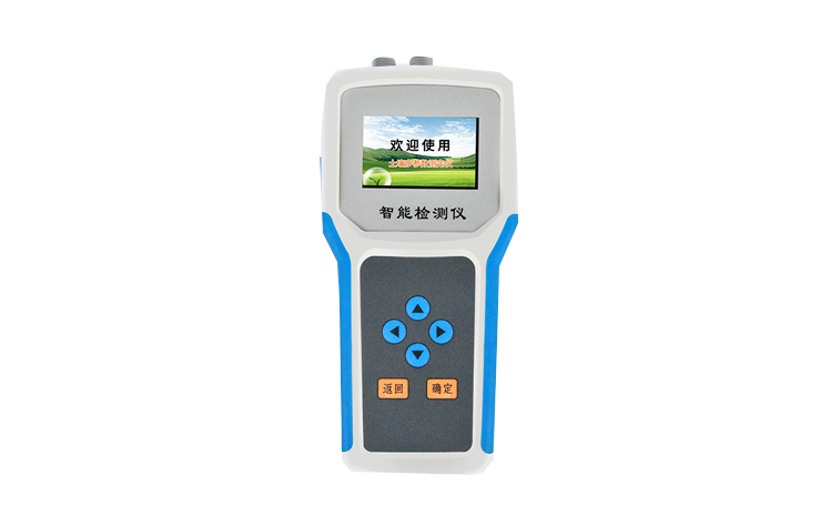
This machine is compact in size, beautiful, easy to operate, reliable in performance, and extremely convenient to carry in the wild. After connecting the sensor to the host, the records can be manually stored or the sampling interval can be set arbitrarily by the host to automatically store the recorded data.
The large Chinese LCD display tracks and records the values, number of groups, and low voltage warnings of various tested environmental factors throughout the process. The host has a built-in large capacity memory that can store 300000 pieces of data and has automatic power-off data storage protection function.
After inserting each sensor into the host, the host has automatic recognition function, good sensor consistency, and can combine sensors according to needs. Sensor interfaces with different parameters can be converted to each other without affecting measurement accuracy.
The instrument has multi-channel automatic detection extension function, which can achieve synchronous detection of multiple sensors simultaneously connected.
The upper computer software has powerful functions, and can export the recorded data to the computer at any time through the USB interface, and store it as an EXCEL table file to generate data curves for further data processing by other analysis software. It has the function of coloring the area that exceeds the limit, and the color change warning of the exceeded data can be used as a basis for environmental evaluation.

Scan QR code on WeChat